← All documents
How the County put it up for sale · January 2020
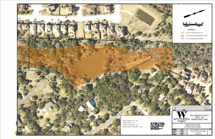
County Floodplain Exhibit (January 2020)
The County's own map of the tract, labeled: "AREA OF PROPERTY = 7.4 AC · AREA OF POND = 1.2 AC · AREA OF FLOODPLAIN = 4 AC · AREA OUTSIDE FLOODPLAIN = 3.4 AC," with the 100-year floodplain (Atlas 14) shaded.
Why it matters
By the County's own measurement, more than half of the park is in the 100-year floodplain. The two later three-lot layouts were drawn over this same ground.
- Source
- Williamson County Department of Infrastructure map exhibit, from the County's May 2026 records production. · ID W11
- File
- PDF · 1 page · 4.2 MB · Open in a new tab · Download
Viewer not showing? Open the PDF
This exhibit was prepared by the Williamson County Department of Infrastructure and appears in the County’s file alongside the 2019 and 2025 three-lot layouts. It is the source for the floodplain figures used elsewhere on this site.